

























Nepal Flood Timeline: How a Sudden Himalayan Deluge Turned Into a Catastrophe
A devastating flash flood swept through Nepal’s Bhotekoshi, Trishuli, and Narayani river systems on August 26, 2026. A technical report says a lake formed after a river blockage on the Tibet side burst, sending a massive surge downstream.

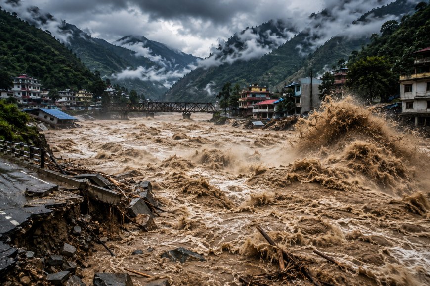
A sudden and devastating flood in Nepal on August 26, 2026, transformed the Bhotekoshi river system into a deadly torrent within hours. The disaster began in the Himalayan region near the Nepal-China border and later spread downstream through the Bhotekoshi, Trishuli and Narayani river corridors.
According to Nepal’s Flood Forecasting Division, a lake formed after the river was blocked on the Tibet side eventually burst, sending a huge volume of water downstream through Rasuwa and beyond. Four automatic hydrological monitoring stations were swept away, while an initial assessment estimated that around 20 million cubic metres of additional water passed through the Devghat area during the flood.
8:37 AM — Earthquake Recorded
The timeline began at 8:37 AM, when Nepal’s Department of Mines and Geology recorded a 4.4-magnitude earthquake. Shortly afterward, a massive flood entered the Bhotekoshi from the Tibet side.
The exact relationship between the earthquake and the flood is still being investigated. Preliminary assessments have pointed to an ice-rock avalanche or debris blockage that may have created a temporary lake before it suddenly burst.
8:50 AM — Hydrological Data Stops
At around 8:50 AM, the Bhotekoshi-Syafrubesi hydrological station stopped transmitting data. Its last recorded water level at 8:40 AM was 1.62 metres, well below the warning and danger thresholds, highlighting how rapidly conditions changed.
9:00 AM — Flood Alert Reaches Authorities
By 9:00 AM, authorities received information that a major flood had entered the Bhotekoshi from the Tibet side.
Within minutes, Nepal’s Flood Forecasting Division began issuing warnings to vulnerable communities along the Trishuli river corridor. Between 9:15 and 9:16 AM, the first early-warning messages were sent to residents downstream.
9:20 AM — Another Monitoring Station Goes Offline
At 9:20 AM, the Betrawati hydrological station also stopped transmitting data. Its last recorded water level was 3.55 metres.
The rapidly moving floodwater continued downstream, putting settlements and infrastructure along the river system at increasing risk.
10:28 AM — Flood Reaches Dhading
At approximately 10:28 AM, the flood was reported around Galchhi in Dhading district. Authorities issued further warnings for communities along the Prithvi Highway, the Muglin–Narayangadh road corridor and the Trishuli river.
11:26 AM — Water Crosses Warning Level
The situation became even more dangerous at 11:26 AM, when the water level at the Fhurke Khola hydrological station in Malekhu crossed the warning level.
Just 17 minutes later, at 11:43 AM, the water crossed the danger level. Shortly afterward, the monitoring station and bridge were swept away by the flood.
11:50 AM — Flood Reaches Malekhu Bazaar
By 11:50 AM, floodwaters had reached the Malekhu Bazaar area, carrying enormous quantities of water and debris downstream.
1:00 PM — Flood Passes Muglin
At around 1:00 PM, the flood had passed Muglin. Authorities continued warning communities downstream, including people living near the Devghat area, to move to safer locations.
20 Million Cubic Metres of Additional Water
The scale of the disaster becomes clearer from the preliminary technical assessment. Officials estimate that approximately 20 million cubic metres of additional water passed through Devghat during the flood.
The sheer force of the water also destroyed four automatic hydrological monitoring stations along the river system.
Nearly 680,000 Early-Warning SMS Messages
Despite the speed of the disaster, Nepal’s authorities activated an early-warning system. In coordination with Nepal Telecom and Ncell, 679,295 warning SMS messages were sent to people in vulnerable areas of Rasuwa, Nuwakot, Dhading and Chitwan.
Officials said the timely warnings helped many people move to safer locations and save their lives.
What Triggered the Flood?
The precise trigger remains under investigation. Initial reports considered an earthquake-related landslide or avalanche, while satellite imagery and subsequent technical assessments pointed toward an ice-rock avalanche/debris blockage that created a temporary lake, followed by its sudden release.
Reuters also reported that experts believe a glacier collapse may have triggered the flash flood, with the possibility that the recent earthquake destabilized the high-altitude terrain. Investigations are continuing.
The disaster demonstrates how quickly conditions can change in the Himalayan river system. Within just a few hours, a sudden surge from the upper mountains travelled through multiple river corridors, destroying infrastructure and putting communities far downstream at risk.
What's Your Reaction?
 Like
0
Like
0
 Dislike
0
Dislike
0
 Love
0
Love
0
 Funny
0
Funny
0
 Angry
0
Angry
0
 Sad
0
Sad
0
 Wow
0
Wow
0