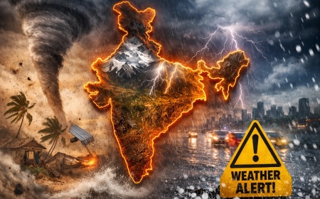


India’s Weather Takes Dramatic Turn as Rain and Hailstorm Alerts Replace Relentless Heatwave
India is experiencing a dramatic weather turnaround as rain, thunderstorms, and hailstorm alerts replace weeks of intense heatwave conditions. IMD forecasts indicate falling temperatures, strong winds, and widespread precipitation across several northern and central states.

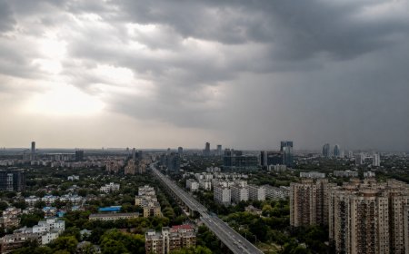
After weeks of scorching temperatures and intense heatwave conditions, India is witnessing a major weather transformation as thunderstorms, rainfall, and hailstorm activity sweep across several regions. The India Meteorological Department (IMD) has indicated that a western disturbance combined with moisture-laden winds is triggering widespread weather changes, bringing an end to the prolonged spell of extreme heat in many parts of the country. The development marks one of the most significant weather shifts of the pre-monsoon season, with temperatures expected to fall considerably across several northern and central states over the coming days.
Heatwave Conditions Weaken as Temperatures Begin to Drop
The relentless heatwave that gripped large parts of North India throughout May has started losing its intensity. Several cities that recorded temperatures above 45°C are expected to witness a noticeable decline as cloud cover, rainfall, and strong winds move into the region. Meteorologists predict a temperature drop of up to 5–8 degrees Celsius in some areas, offering relief to millions of residents who have endured one of the hottest periods of the year. The cooling trend is expected to continue as weather systems remain active across northern India.
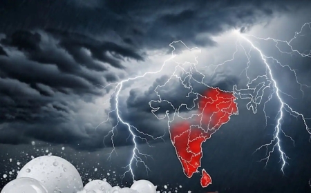
Rain, Thunderstorms, and Hailstorms Trigger Fresh Alerts
The IMD has issued weather alerts for multiple states, warning of thunderstorms accompanied by lightning, gusty winds, and isolated hailstorm activity. Regions including Delhi-NCR, Haryana, Punjab, Uttar Pradesh, Rajasthan, Madhya Pradesh, Uttarakhand, and Himachal Pradesh are likely to experience varying intensities of rainfall over the next few days. Wind speeds ranging from 40 to 80 kmph are expected in some locations, increasing the risk of tree falls, temporary power disruptions, and transportation delays. Hailstorm activity is also forecast in isolated pockets, particularly across northwestern and central India.
Western Disturbance Drives the Changing Weather Pattern
According to weather experts, the sudden change is being driven by an active western disturbance interacting with warm surface temperatures and moisture from the Arabian Sea. This combination has created favorable conditions for the formation of thunderstorms and widespread precipitation. Such weather transitions are common during the pre-monsoon period, but the scale and intensity of the current system have drawn attention due to the sharp contrast from the severe heat conditions experienced just days earlier.
Impact on Daily Life and Agriculture
The arrival of rain is expected to provide significant relief to farmers, reduce water stress in some regions, and improve air quality in urban centers. However, authorities have advised residents to remain cautious during thunderstorms due to the possibility of lightning strikes, localized flooding, and strong winds. Transport services, including flights and road traffic, may also face temporary disruptions in areas experiencing severe weather conditions.
Monsoon Progress Under Close Watch
The latest weather developments come as meteorologists closely monitor the advance of the southwest monsoon. Experts believe the current pattern could support favorable conditions for monsoon progression, although official forecasts will determine the exact timeline of its movement across the country. For now, the immediate focus remains on managing the transition from extreme heat to potentially severe storm activity, a change that is already reshaping weather conditions across much of India.
What's Your Reaction?
 Like
0
Like
0
 Dislike
0
Dislike
0
 Love
0
Love
0
 Funny
0
Funny
0
 Angry
0
Angry
0
 Sad
0
Sad
0
 Wow
0
Wow
0